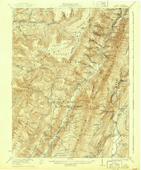
1922 Map of Onego
USGS Topo · Published 1944About this map
The Allegheny Frontier and the steep ridges of North Fork Mountain dominate this landscape, which was surveyed shortly after the end of World War I. This territory within the Monongahela National Forest is defined by isolated upland communities and the winding waters of the North Fork and Seneca Creek. Distinctive community enclaves like the Germany Settlement and the Smoke Hole Settlement illustrate the deep-rooted cultural geography of Pendleton County, where families established themselves along fertile hollows and gaps.
Find a feature on this map
92 named features on this map. Tap any name to fly to it.
Don’t see what you’re looking for? This feature index may not catch every label — zoom into the map to look around manually.
Map Details
Editions of this 1922 Onego Map
2 editions found

Other maps of this area

1886 · St. George
USGS Topo · 1:125,000

1889 · Beverly
USGS Topo · 1:125,000

1891 · St. George
USGS Topo · 1:125,000

1892 · Beverly
USGS Topo · 1:125,000

1892 · Franklin
USGS Topo · 1:125,000

1895 · Piedmont
USGS Topo · 1:125,000

1896 · Franklin
USGS Topo · 1:125,000

1908 · Parsons
USGS Topo · 1:62,500

1916 · Davis
USGS Topo · 1:48,000

1918 · Davis
USGS Topo · 1:62,500