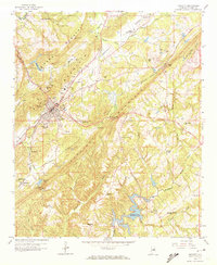
1958 Map of Oneonta
USGS Topo · Published 1972About this map
Oneonta serves as the focal point of this late 1950s study, situated at the base of Red Mountain where the Louisville and Nashville railroad runs parallel to the ridge. The landscape is defined by a series of parallel mountains, including Sand Mountain and Straight Mountain, which dictate the orientation of settlements and transport lines. To the south, the recently developed Highland Lake marks a significant change in the local geography, while industry is evident through numerous extraction sites like the Gravel Pit near Champion and multiple Strip Mines on the eastern slopes.
Find a feature on this map
60 named features on this map. Tap any name to fly to it.
Don’t see what you’re looking for? This feature index may not catch every label — zoom into the map to look around manually.
Map Details
Editions of this 1958 Oneonta Map
Other maps of this area

1885 · Gadsden
USGS Topo · 1:125,000

1888 · Cullman
USGS Topo · 1:125,000

1888 · Gadsden
USGS Topo · 1:125,000

1889 · Springville
USGS Topo · 1:125,000

1889 · Birmingham
USGS Topo · 1:125,000

1892 · Cullman
USGS Topo · 1:125,000

1892 · Birmingham
USGS Topo · 1:125,000

1892 · Springville
USGS Topo · 1:125,000

1892 · Gadsden
USGS Topo · 1:125,000

1895 · Gadsden
USGS Topo · 1:125,000