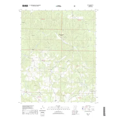
2020 Map of Onia
USGS Topo · Published 2020About this map
Onia serves as a central point in this part of Stone County, where the landscape is defined by the winding drainages of Roasting Ear Cr and Panther Cr. The map illustrates a rural settlement pattern concentrated along ridge roads and creek bottoms, with small communities like Alco, Timbo, and Newnata connected by a network of county roads. Large portions of the terrain fall within the Ozark National Forest, particularly in the northern reaches near Sugar Hollow and Murry Treat Hollow. Family history is well-preserved through numerous small burial grounds, including Stevens Cem, Purdue Cem, and Smithee Cem, which are often situated near original homesteads or crossroads. Significant local landmarks such as Ramsey Knob and Panther Mtn overlook the intricate system of hollows and springs, like Big Spring, that historically dictated the placement of farms and homes in this Ozark region.
Find a feature on this map
73 named features on this map. Tap any name to fly to it.
Don’t see what you’re looking for? This feature index may not catch every label — zoom into the map to look around manually.
Map Details
Editions of this 2020 Onia Map
This is the sole edition of this map. No revisions or reprints were ever made.
Other maps of this area

1890 · Mountain Home
USGS Topo · 1:125,000

1891 · Mountain Home
USGS Topo · 1:125,000

1892 · Mountain View
USGS Topo · 1:125,000

1894 · Mountain View
USGS Topo · 1:125,000

1894 · Mountain Home
USGS Topo · 1:125,000

1945 · Harrison
USGS Topo · 1:250,000

1949 · Harrison
USGS Topo · 1:250,000

1954 · Harrison
USGS Topo · 1:250,000

1956 · Russellville
USGS Topo · 1:250,000

1958 · Harrison
USGS Topo · 1:250,000