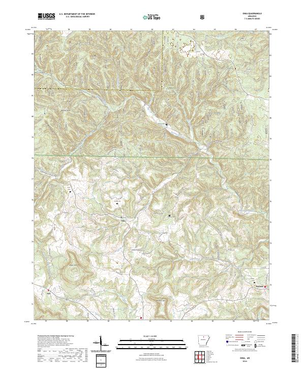
2024 Map of Onia
USGS Topo · Published 2024About this map
Small rural settlements and family burial grounds are tucked into the valleys of the Ozark National Forest south of the Baxter and Stone county line. This upland area is defined by the network of waterways flowing through deep gaps, including Roasting Ear Creek and Mill Creek. The landscape transition from high points like Ramsey Knob and Roper Mtn down to the creek beds illustrates the traditional settlement pattern of this region, where communities such as Onia, Alco, and Newnata follow the natural contours of the land. Genealogists will find a concentrated cluster of small family cemeteries, including Farris Cem, Purdue Cem, and Smithee Cem, which remain scattered across the ridges and valley floors. Notable landmarks like Big Spring and Panther Mtn serve as distinct reference points in this sparsely populated portion of the Arkansas Ozarks.
Find a feature on this map
72 named features on this map. Tap any name to fly to it.
Don’t see what you’re looking for? This feature index may not catch every label — zoom into the map to look around manually.
Map Details
Editions of this 2024 Onia Map
This is the sole edition of this map. No revisions or reprints were ever made.
Other maps of this area

1890 · Mountain Home
USGS Topo · 1:125,000

1891 · Mountain Home
USGS Topo · 1:125,000

1892 · Mountain View
USGS Topo · 1:125,000

1894 · Mountain View
USGS Topo · 1:125,000

1894 · Mountain Home
USGS Topo · 1:125,000

1945 · Harrison
USGS Topo · 1:250,000

1949 · Harrison
USGS Topo · 1:250,000

1954 · Harrison
USGS Topo · 1:250,000

1956 · Russellville
USGS Topo · 1:250,000

1958 · Harrison
USGS Topo · 1:250,000