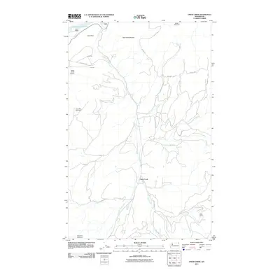
2011 Map of Onion Creek
USGS Topo · Published 2011About this map
Onion Creek winds through a high-elevation landscape of the Selkirk Mountains in this detailed 2011 survey of northeast Washington. The map highlights a history of mineral extraction and transit, evidenced by industrial sites like the Van Stone Mine and local settlements including Dolomite and Limerock. The topography is defined by prominent peaks such as Black Hawk Mountain and Alice Mae Mountain, which overlook a network of logging and access roads including Wilcox Rd and Quinns Meadow Rd.
Find a feature on this map
29 named features on this map. Tap any name to fly to it.
Don’t see what you’re looking for? This feature index may not catch every label — zoom into the map to look around manually.
Map Details
Editions of this 2011 Onion Creek Map
This is the sole edition of this map. No revisions or reprints were ever made.
Other maps of this area

1929 · Colville
USGS Topo · 1:125,000

1933 · Colville
USGS Topo · 1:125,000

1952 · Gillette Mtn
USGS Topo · 1:24,000

1952 · Spirit
USGS Topo · 1:24,000

1952 · Echo Valley
USGS Topo · 1:24,000

1952 · Boundary
USGS Topo · 1:24,000

1952 · Aladdin
USGS Topo · 1:24,000

1958 · Sandpoint
USGS Topo · 1:250,000

1963 · Sandpoint
USGS Topo · 1:250,000
1966 · Aladdin
USGS Topo · 1:24,000