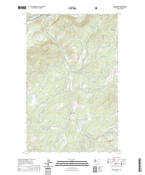
2023 Map of Onion Creek
USGS Topo · Published 2023About this map
Onion Creek flows northward through a landscape of significant elevation changes in Stevens County, eventually reaching the Columbia River and Lake Roosevelt. The topography is dominated by prominent summits such as Black Hawk Mtn, Alice Mae Mtn, and Staghorn Mtn, which frame the deep drainage basins of the area. This modern survey illustrates the proximity of the Lake Roosevelt National Recreation Area to local landmarks like Island Rock and the narrow passage at Little Dalles. The road network, including Van Stone Mine Rd and Bodie Mountain Rd, reveals how transport follows the natural contours of the canyons. The naming of features like White Horse Canyon and Widow Hawks Branch Rd suggests a history of localized settlement and family landholdings tied to these high-altitude drainages.
Find a feature on this map
35 named features on this map. Tap any name to fly to it.
Don’t see what you’re looking for? This feature index may not catch every label — zoom into the map to look around manually.
Map Details
Editions of this 2023 Onion Creek Map
This is the sole edition of this map. No revisions or reprints were ever made.
Other maps of this area

1929 · Colville
USGS Topo · 1:125,000

1933 · Colville
USGS Topo · 1:125,000

1952 · Gillette Mtn
USGS Topo · 1:24,000

1952 · Spirit
USGS Topo · 1:24,000

1952 · Echo Valley
USGS Topo · 1:24,000

1952 · Boundary
USGS Topo · 1:24,000

1952 · Aladdin
USGS Topo · 1:24,000

1958 · Sandpoint
USGS Topo · 1:250,000

1963 · Sandpoint
USGS Topo · 1:250,000
1966 · Aladdin
USGS Topo · 1:24,000