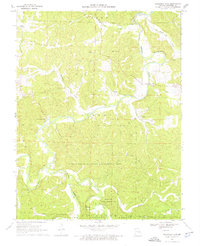
1969 Map of Onondaga Cave
USGS Topo · Published 1976About this map
Onondaga Cave and Cathedral Cave anchor this 1960s study of the karst-heavy landscape where the Meramec River, Huzzah Creek, and Courtois Creek converge. The topography is defined by intricate bluff systems and numerous subterranean features, including Bat Cave, Bear Cave, and Dry Cave. Human settlements like Vilander and Scotia appear alongside rural landmarks such as Harrison Cem and the Fairview Ch. Large tracts of land are dedicated to the Huzzah State Wildlife Management Area and Clark National Forest, reflecting a landscape managed for conservation and recreation. The mapping of the Meramec River's winding course reveals the importance of river crossings, evidenced by the Campbell Bridge and the surrounding river-bottom terrain.
Find a feature on this map
36 named features on this map. Tap any name to fly to it.
Don’t see what you’re looking for? This feature index may not catch every label — zoom into the map to look around manually.
Map Details
Editions of this 1969 Onondaga Cave Map
3 editions found
Other maps of this area

1903 · Sullivan
USGS Topo · 1:125,000

1932 · Steelville
USGS Topo · 1:48,000

1933 · Steelville
USGS Topo · 1:62,500

1934 · Meramec State Park
USGS Topo · 1:24,000

1937 · Steelville
USGS Topo · 1:62,500

1937 · Meramec State Park
USGS Topo · 1:24,000

1943 · Berryman
USGS Topo · 1:62,500

1945 · Berryman
USGS Topo · 1:62,500

1947 · Sullivan
USGS Topo · 1:62,500

1948 · Leasburg
USGS Topo · 1:24,000