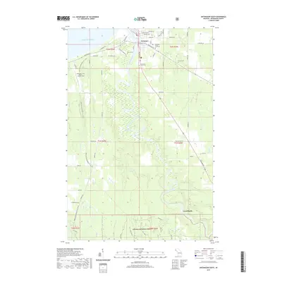
2019 Map of Ontonagon South
USGS Topo · Published 2019About this map
Ontonagon sits at the northern edge of this Lake Superior watershed, serving as a focal point where the Ontonagon River meets the Great Lakes shore. This 2019 survey documents a landscape defined by the winding river valley as it carves through the transition from the town's residential grid to the heavily forested interior. Local history is anchored by the Ontonagon County Courthouse and a series of burial grounds including Riverside Cem, Evergreen Cem, and the Holy Family Catholic Cem.
Find a feature on this map
67 named features on this map. Tap any name to fly to it.
Don’t see what you’re looking for? This feature index may not catch every label — zoom into the map to look around manually.
Map Details
Editions of this 2019 Ontonagon South Map
This is the sole edition of this map. No revisions or reprints were ever made.
Other maps of this area

1949 · Matchwood NW
USGS Topo · 1:24,000

1949 · Rockland
USGS Topo · 1:62,500

1950 · Greenland
USGS Topo · 1:62,500

1951 · Rockland
USGS Topo · 1:62,500

1951 · Greenland
USGS Topo · 1:62,500

1955 · Ontonagon
USGS Topo · 1:62,500

1956 · Matchwood NW
USGS Topo · 1:24,000

1956 · Matchwood
USGS Topo · 1:62,500

1958 · Iron River
USGS Topo · 1:250,000

1960 · Iron River
USGS Topo · 1:250,000