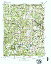
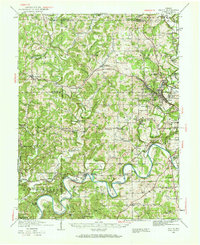
1935 Map of Oolitic
USGS Topo · Published 1968About this map
The limestone industry of southern Indiana is on clear display in this mid-1930s landscape, centered on the quarrying town of Oolitic. Heavy industrial activity is clustered near Dark Hollow Quarry and the Reed Kurrie Quarry, where the Louisville and Nashville and the Chicago Milwaukee St Paul and Pacific railroads provided the vital transit links for stone and labor. Beyond the industrial corridors, the terrain transitions into a dense network of rural communities and family landmarks such as Freeman Cem and the Bridge Ch. The White River carves dramatic loops through the southern portion of the map, including Henshaw Bend and Horseshoe Bend, while local infrastructure is marked by crossings like Stumphole Bridge. This survey reflects an era when small-scale agriculture, evidenced by the Experiment Farm and numerous one-room schoolhouses like Sulphur Sch, still shared the landscape with a growing mineral economy.
Find a feature on this map
89 named features on this map. Tap any name to fly to it.
Don’t see what you’re looking for? This feature index may not catch every label — zoom into the map to look around manually.
Map Details
Editions of this 1935 Oolitic Map
6 editions found
Other maps of this area

1908 · Bloomington
USGS Topo · 1:48,000

1908 · Bloomfield
USGS Topo · 1:62,500

1910 · Bloomington
USGS Topo · 1:62,500

1934 · Bedford
USGS Topo · 1:48,000

1935 · Oolitic
USGS Topo · 1:48,000

1937 · Bedford
USGS Topo · 1:62,500

1942 · Franklin
USGS Topo · 1:125,000

1942 · Oolitic
USGS Topo · 1:62,500

1947 · Allens Creek
USGS Topo · 1:24,000

1948 · Huron
USGS Topo · 1:24,000