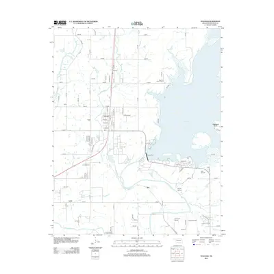
2013 Map of Oologah
USGS Topo · Published 2013About this map
The Verdigris River and Caney River define this Rogers County landscape, which by 2013 was dominated by the expansive Oologah Lake and its associated Oologah Dam. The town of Oologah sits as the central hub, with a network of residential streets such as Atlas Ave and Lake Ave giving way to the surrounding Oologah Oil Field. This survey captures a mix of rural prairie and developed recreation areas like Edgewater Acres, while preserving several family-named landmarks. Genealogists and local historians will find the locations of the Oologah Cem, Wann Cem, and Bushyhead Cem particularly useful. The terrain is marked by distinct topographical features including Lipe Mound, Brushy Mound, and Claremore Mound, which rise above the river plains. Small private airfields, including Dog Iron Ranch Airport and Sageeyah Airfield, illustrate the modern aviation character of the region.
Find a feature on this map
81 named features on this map. Tap any name to fly to it.
Don’t see what you’re looking for? This feature index may not catch every label — zoom into the map to look around manually.
Map Details
Editions of this 2013 Oologah Map
This is the sole edition of this map. No revisions or reprints were ever made.
Other maps of this area

1901 · Claremore
USGS Topo · 1:125,000

1901 · Nowata
USGS Topo · 1:125,000

1914 · Nowata
USGS Topo · 1:125,000

1914 · Claremore
USGS Topo · 1:125,000

1916 · Claremore
USGS Topo · 1:125,000

1954 · Tulsa
USGS Topo · 1:250,000

1956 · Collinsville
USGS Topo · 1:24,000

1958 · Tulsa
USGS Topo · 1:250,000

1959 · Collinsville NE
USGS Topo · 1:24,000

1963 · Tulsa
USGS Topo · 1:250,000