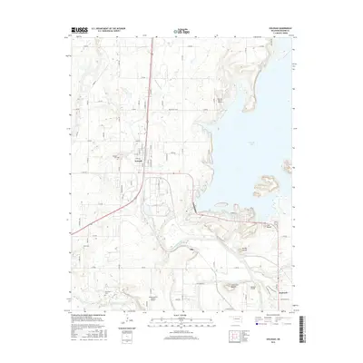
2016 Map of Oologah
USGS Topo · Published 2016About this map
Oologah and the surrounding Rogers County prairie are defined here by the meeting of the Verdigris River and the expansive Oologah Lake. This 2016 survey highlights a landscape where aviation and agriculture intersect, featuring several private landing strips like the Dog Iron Ranch Airport and Sageeyah Airfield alongside traditional ranching lands. The terrain is marked by distinctive elevations including Lipe Mound and Claremore Mound, which rise above the river bottomlands near the confluence of the Caney River. Local genealogy is well-supported by the presence of family and community resting places, such as the Wann Cem and Bushyhead Cem, providing important geographic markers for those tracing local heritage. The layout of Oologah itself shows a clear grid organized around S Pine St and S Hwy 169, serving as a gateway to the recreational and utility value of the nearby reservoir.
Find a feature on this map
64 named features on this map. Tap any name to fly to it.
Don’t see what you’re looking for? This feature index may not catch every label — zoom into the map to look around manually.
Map Details
Editions of this 2016 Oologah Map
This is the sole edition of this map. No revisions or reprints were ever made.
Other maps of this area

1901 · Claremore
USGS Topo · 1:125,000

1901 · Nowata
USGS Topo · 1:125,000

1914 · Nowata
USGS Topo · 1:125,000

1914 · Claremore
USGS Topo · 1:125,000

1916 · Claremore
USGS Topo · 1:125,000

1954 · Tulsa
USGS Topo · 1:250,000

1956 · Collinsville
USGS Topo · 1:24,000

1958 · Tulsa
USGS Topo · 1:250,000

1959 · Collinsville NE
USGS Topo · 1:24,000

1963 · Tulsa
USGS Topo · 1:250,000