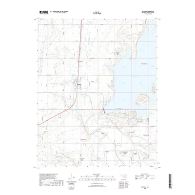
2018 Map of Oologah
USGS Topo · Published 2018About this map
Oologah serves as the focal point of this Rogers County landscape, situated where the high plains meet the intricate water networks of the Verdigris River and Oologah Lake. This 2018 survey reveals a topography defined by prominent natural rises such as Claremore Mound, Lipe Mound, and Brushy Mound, which stand out against the river valleys. The convergence of the Caney River and the Verdigris highlights the importance of the regional watershed, while several small airfields, including Dog Iron Ranch Airport and Sageeyah Airfield, indicate the area's rural aviation character.
Find a feature on this map
42 named features on this map. Tap any name to fly to it.
Don’t see what you’re looking for? This feature index may not catch every label — zoom into the map to look around manually.
Map Details
Editions of this 2018 Oologah Map
This is the sole edition of this map. No revisions or reprints were ever made.
Other maps of this area

1901 · Claremore
USGS Topo · 1:125,000

1901 · Nowata
USGS Topo · 1:125,000

1914 · Nowata
USGS Topo · 1:125,000

1914 · Claremore
USGS Topo · 1:125,000

1916 · Claremore
USGS Topo · 1:125,000

1954 · Tulsa
USGS Topo · 1:250,000

1956 · Collinsville
USGS Topo · 1:24,000

1958 · Tulsa
USGS Topo · 1:250,000

1959 · Collinsville NE
USGS Topo · 1:24,000

1963 · Tulsa
USGS Topo · 1:250,000