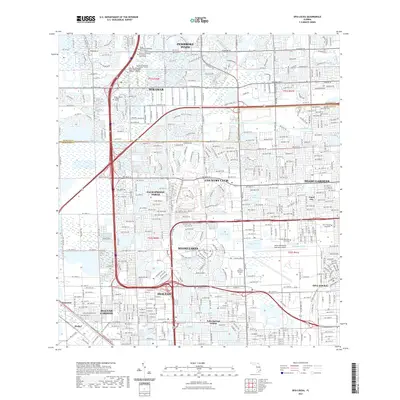
2021 Map of Opa-locka
USGS Topo · Published 2021About this map
Miami Lakes and the surrounding urban corridors of northern Miami-Dade and southern Broward counties are defined by an intricate network of drainage canals and artificial lakes in this recent survey. The landscape is heavily residential and institutional, characterized by sprawling suburban developments like Country Club and Palm Springs North that are woven around water bodies such as Lake Steven and Lake Ruth. The transition from the dense street grids of Miami Gardens and Hialeah to the more open campus environments of Florida Memorial University and Saint Thomas University is clearly visible.
Find a feature on this map
41 named features on this map. Tap any name to fly to it.
Don’t see what you’re looking for? This feature index may not catch every label — zoom into the map to look around manually.
Map Details
Editions of this 2021 Opa-locka Map
This is the sole edition of this map. No revisions or reprints were ever made.
Other maps of this area

1947 · North Miami
USGS Topo · 1:24,000

1949 · Opalocka
USGS Topo · 1:24,000

1949 · Fort Lauderdale South
USGS Topo · 1:24,000

1950 · Hialeah
USGS Topo · 1:24,000

1950 · Miami
USGS Topo · 1:24,000

1950 · North Miami
USGS Topo · 1:24,000

1956 · Miami
USGS Topo · 1:250,000

1956 · West Palm Beach
USGS Topo · 1:250,000

1957 · West Palm Beach
USGS Topo · 1:250,000

1958 · West Palm Beach
USGS Topo · 1:250,000