2024 Map of Opa-locka
USGS Topo · Published 2024About this map
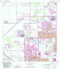
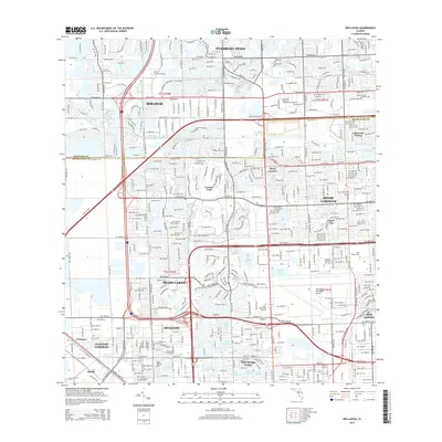
The boundary between Broward and Miami-Dade counties anchors this urban landscape, where planned residential developments meet a complex system of waterways. Large-scale educational institutions and aviation infrastructure define the eastern and central regions, notably the Miami-Opa Locka Executive Airport and Saint Thomas University. The dense grid of Hialeah and Miami Gardens is punctuated by numerous artificial basins and drainage routes, including the Snake Creek Canal and Biscayne Canal.
Find a feature on this map
45 named features on this map. Tap any name to fly to it.
Don’t see what you’re looking for? This feature index may not catch every label — zoom into the map to look around manually.
Map Details
Editions of this 2024 Opa-locka Map
This is the sole edition of this map. No revisions or reprints were ever made.
Historical Maps of Miami Lakes Through Time
6 maps found