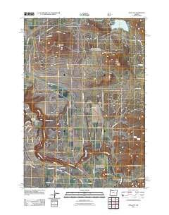
2011 Map of Opal City
USGS Topo · Published 2011About this map
Opal City and the expanding development of Crooked River Ranch anchor this high-desert landscape in Jefferson County. The map details a transition from traditional agricultural infrastructure, such as the North Main Unit Canal, to modern residential grids. The Crooked River Ranch Post Office serves as a central landmark for a community characterized by its proximity to the winding Crooked River and several prominent geological formations, including Juniper Butte and Haystack Butte. In the northeast corner, Haystack Reservoir stands as a primary water feature, while several named springs like Nichols Spring and Meralle Spring dot the more arid sections. The road network reflects a mixture of rural highways and suburban-style street naming, indicating the area's growth in the early 21st century. Researchers will find a distinct contrast between the older agricultural canals and the emerging street patterns that define this part of the Oregon interior.
Find a feature on this map
48 named features on this map. Tap any name to fly to it.
Don’t see what you’re looking for? This feature index may not catch every label — zoom into the map to look around manually.
Map Details
Editions of this 2011 Opal City Map
This is the sole edition of this map. No revisions or reprints were ever made.
Other maps of this area
1926 · Bend
USGS Topo · 1:125,000
1928 · Madras
USGS Topo · 1:125,000
1929 · Bend
USGS Topo · 1:125,000
1931 · Madras
USGS Topo · 1:125,000
1955 · Bend
USGS Topo · 1:250,000
1957 · Bend
USGS Topo · 1:250,000
1958 · Bend
USGS Topo · 1:250,000
1961 · Redmond
USGS Topo · 1:24,000
1962 · Opal City
USGS Topo · 1:24,000
1962 · Oneil
USGS Topo · 1:24,000