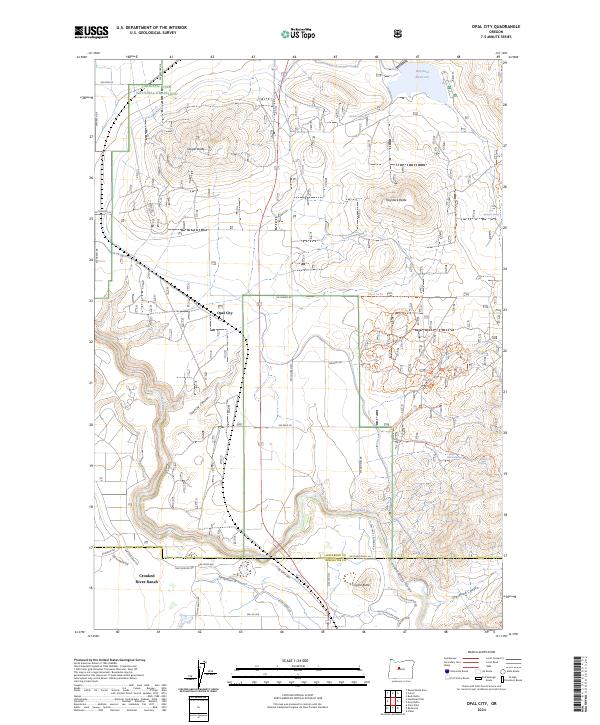
2024 Map of Opal City
USGS Topo · Published 2024About this map
The high desert landscape of Jefferson County is defined by the sharp descent of the Crooked River and its dramatic Crooked River Gorge. This contemporary survey shows the interface between the Crooked River National Grassland and more recently developed areas like Crooked River Ranch near the southern border. The map documents the vital water infrastructure of the Central Oregon district, including Haystack Reservoir in the northeast and several local water sources such as Osborne Spring and Metolius Spring.
Find a feature on this map
53 named features on this map. Tap any name to fly to it.
Don’t see what you’re looking for? This feature index may not catch every label — zoom into the map to look around manually.
Map Details
Editions of this 2024 Opal City Map
This is the sole edition of this map. No revisions or reprints were ever made.
Other maps of this area

1926 · Bend
USGS Topo · 1:125,000

1928 · Madras
USGS Topo · 1:125,000

1929 · Bend
USGS Topo · 1:125,000

1931 · Madras
USGS Topo · 1:125,000

1955 · Bend
USGS Topo · 1:250,000

1957 · Bend
USGS Topo · 1:250,000

1958 · Bend
USGS Topo · 1:250,000

1961 · Redmond
USGS Topo · 1:24,000

1962 · Opal City
USGS Topo · 1:24,000

1962 · Oneil
USGS Topo · 1:24,000