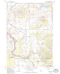
1985 Map of Opal City
USGS Topo · Published 1986About this map
Crooked River carves a deep path through this high desert landscape, defining the border between Jefferson and Deschutes counties. This mid-1980s data highlights the critical water infrastructure supporting the region, from the North Unit Main Canal to the Haystack Reservoir and its associated campground. The map documents the settlement pattern of Opal City and the expanding footprint of Crooked River Ranch atop the bluffs, while prominent landmarks like Juniper Butte and Haystack Butte rise sharply from the Crooked River National Grassland.
Find a feature on this map
32 named features on this map. Tap any name to fly to it.
Don’t see what you’re looking for? This feature index may not catch every label — zoom into the map to look around manually.
Map Details
Editions of this 1985 Opal City Map
This is the sole edition of this map. No revisions or reprints were ever made.
Other maps of this area

1926 · Bend
USGS Topo · 1:125,000

1928 · Madras
USGS Topo · 1:125,000

1929 · Bend
USGS Topo · 1:125,000

1931 · Madras
USGS Topo · 1:125,000

1955 · Bend
USGS Topo · 1:250,000

1957 · Bend
USGS Topo · 1:250,000

1958 · Bend
USGS Topo · 1:250,000

1961 · Redmond
USGS Topo · 1:24,000

1962 · Opal City
USGS Topo · 1:24,000

1962 · Oneil
USGS Topo · 1:24,000