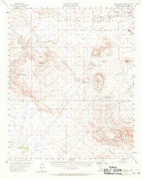
1955 Map of Opal Mountain
USGS Topo · Published 1971About this map
Opal Mountain and Black Mountain rise above a landscape defined by desert hydrology and early ranching efforts in the mid-1950s. The southern portion of the map showcases the geological complexity of the Mud Hills, where Fossil Canyon and Coon Canyon converge near the notable Rainbow Basin. This area is accessed by Fossil Bed Rd, indicating the region's significance for paleontological discovery and geological study.
Find a feature on this map
30 named features on this map. Tap any name to fly to it.
Don’t see what you’re looking for? This feature index may not catch every label — zoom into the map to look around manually.
Map Details
Editions of this 1955 Opal Mountain Map
3 editions found

Other maps of this area

1915 · Searles Lake
USGS Topo · 1:250,000

1932 · Barstow
USGS Topo · 1:125,000

1933 · Avawatz Mountains
USGS Topo · 1:250,000

1934 · Barstow
USGS Topo · 1:125,000

1947 · Trona
USGS Topo · 1:250,000

1948 · Trona
USGS Topo · 1:250,000

1948 · Lane Mountain
USGS Topo · 1:62,500

1948 · Goldstone Lake
USGS Topo · 1:62,500

1951 · Goldstone Lake
USGS Topo · 1:62,500

1951 · Lane Mountain
USGS Topo · 1:62,500