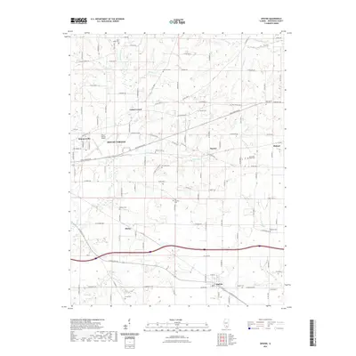
2021 Map of Opdyke
USGS Topo · Published 2021About this map
Mount Vernon anchoring the western edge of this territory reveals a landscape where municipal growth meets a dense network of family cemeteries and rural crossroads. The area around Summersville and the Mount Vernon Airport serves as a transition from the urban center to the agricultural reaches of eastern Jefferson County. Moving east toward Bluford and Marlow, the terrain is defined by the branching tributaries of Casey Fork, Twomile Cr, and Fourmile Cr. For genealogists, the map is particularly detailed, identifying numerous burial grounds such as East Salem Cem, Atkinson Cem, and Old Orchard Cem that lie scattered between small settlements like Shirley and Opdyke. This modern survey documents the persistent rural infrastructure of southern Illinois, tracing the intersections of named county roads and township routes that have connected these farming communities for generations.
Find a feature on this map
121 named features on this map. Tap any name to fly to it.
Don’t see what you’re looking for? This feature index may not catch every label — zoom into the map to look around manually.
Map Details
Editions of this 2021 Opdyke Map
This is the sole edition of this map. No revisions or reprints were ever made.
Other maps of this area

1933 · Mount Vernon
USGS Topo · 1:48,000

1939 · Ina
USGS Topo · 1:62,500

1940 · Mount Vernon
USGS Topo · 1:62,500

1942 · McLeansboro
USGS Topo · 1:62,500

1943 · Ina
USGS Topo · 1:62,500

1945 · McLeansboro
USGS Topo · 1:62,500

1947 · Wayne City
USGS Topo · 1:62,500

1958 · Belleville
USGS Topo · 1:250,000

1962 · Belleville
USGS Topo · 1:250,000

1964 · Opdyke
USGS Topo · 1:24,000