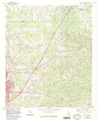
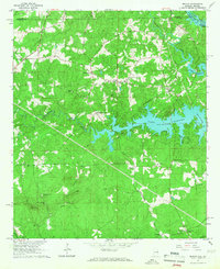
1970 Map of Opelika East
USGS Topo · Published 1984About this map
Opelika anchors the southwestern portion of this landscape during a period of significant growth and infrastructure development. The city's eastern reaches show an evolving mix of educational and social institutions, including the State Vocational Technical Institute, Darden High Sch, and Hattie Turner Sch. To the north and east, the terrain transitions into the rural hills of the Alabama Piedmont, defined by the winding course of Halawakee Creek and several small rural congregations such as St Mark Ch and Bethel Ch.
Find a feature on this map
33 named features on this map. Tap any name to fly to it.
Don’t see what you’re looking for? This feature index may not catch every label — zoom into the map to look around manually.
Map Details
Editions of this 1970 Opelika East Map
4 editions found
Other maps of this area

1907 · Opelika
USGS Topo · 1:125,000

1909 · Opelika
USGS Topo · 1:125,000

1955 · Phenix City
USGS Topo · 1:250,000

1957 · Phenix City
USGS Topo · 1:250,000

1958 · Phenix City
USGS Topo · 1:250,000

1964 · Lanett South
USGS Topo · 1:24,000
1965 · Bleecker
USGS Topo · 1:24,000
1965 · Beulah
USGS Topo · 1:24,000

1970 · Opelika East
USGS Topo · 1:24,000

1971 · Parkers Crossroads
USGS Topo · 1:24,000