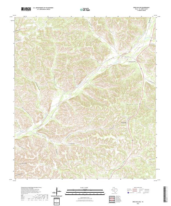
2022 Map of Open Hollow
USGS Topo · Published 2022About this map
Loma Alta sits at the high point of a complex drainage network in the Edwards Plateau region of Val Verde County. The landscape is defined by the ephemeral Dry Devils River, which cuts a broad, meandering path across the terrain, joined by an intricate web of tributary draws and canyons. This ranching territory is accessed by the intersection of Us HWY 377 and local routes like Dolan Creek Rd and Ea Daves Ranch Rd, providing a look at contemporary land use and water management in a semi-arid environment. Named features such as Tom and Henry Canyon and Camp Spring Canyon suggest the historic importance of seasonal water sources and early livestock operations. From the narrow corridor of Steer Canyon to the wide expanse of Vinegarone Draw, the topography reveals how water, even when absent, dictates the movement of people and livestock across this Texas landscape.
Find a feature on this map
28 named features on this map. Tap any name to fly to it.
Don’t see what you’re looking for? This feature index may not catch every label — zoom into the map to look around manually.
Map Details
Editions of this 2022 Open Hollow Map
This is the sole edition of this map. No revisions or reprints were ever made.
Other maps of this area

1943 · Carta Valley
USGS Topo · 1:62,500

1944 · Dry Devil
USGS Topo · 1:62,500

1954 · Sonora
USGS Topo · 1:250,000

1958 · Sonora
USGS Topo · 1:250,000

1958 · Del Rio
USGS Topo · 1:250,000

1964 · Del Rio
USGS Topo · 1:250,000

1973 · Robinson Draw
USGS Topo · 1:24,000

1973 · Four Mills
USGS Topo · 1:24,000
1973 · White Draw
USGS Topo · 1:24,000
1978 · Holcomb Draw
USGS Topo · 1:24,000