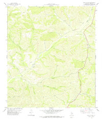
1978 Map of Open Hollow
USGS Topo · Published 1978About this map
The Dry Devils River carves through this portion of Val Verde County, defining a landscape dominated by deep drainage canyons and ranchland infrastructure. In the late 1970s, this area north of Del Rio served as a remote outpost for aviation and livestock, anchored by the Davis Ranch Airport and the small settlements of Vinegarone and Loma Alta. The drainage pattern is exceptionally detailed, featuring family-named or descriptive draws such as Davis Draw, Miers Draw, and Vinegarone Draw. Local topography is further marked by numerous named canyons, including Steer Canyon and Prickly Pear Canyon, which demonstrate the arid, rugged nature of the Texas Hill Country's western fringes. Several gravel pits and drill holes scattered across the terrain reflect the local land use and resource extraction of the era.
Find a feature on this map
29 named features on this map. Tap any name to fly to it.
Don’t see what you’re looking for? This feature index may not catch every label — zoom into the map to look around manually.
Map Details
Editions of this 1978 Open Hollow Map
This is the sole edition of this map. No revisions or reprints were ever made.
Other maps of this area

1943 · Carta Valley
USGS Topo · 1:62,500

1944 · Dry Devil
USGS Topo · 1:62,500

1954 · Sonora
USGS Topo · 1:250,000

1958 · Sonora
USGS Topo · 1:250,000

1958 · Del Rio
USGS Topo · 1:250,000

1964 · Del Rio
USGS Topo · 1:250,000

1973 · Robinson Draw
USGS Topo · 1:24,000

1973 · Four Mills
USGS Topo · 1:24,000
1973 · White Draw
USGS Topo · 1:24,000
1978 · Holcomb Draw
USGS Topo · 1:24,000