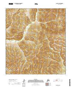
2019 Map of Ophir A-1 SE
USGS Topo · Published 2019About this map
The Sterling Landing-Takotna Ophir Road cuts across the southwestern corner of this landscape, marking a vital terrestrial link in the remote Yukon-Koyukuk region. This thoroughfare bypasses the winding course of the Innoko River, which meanders across the northern sections of the sheet. The drainage pattern here is defined by several seasonal and perennial streams, including Canadian Cr and Gulickson Cr, flowing through the subdivided townships of the Alaska interior. The map illustrates a transition between the low-lying river valley and the elevated ridges that separate these northern watersheds, providing a clear view of the topographical obstacles encountered by early twentieth-century travelers and modern land managers alike in this part of the Ophir mining district.
Find a feature on this map
11 named features on this map. Tap any name to fly to it.
Don’t see what you’re looking for? This feature index may not catch every label — zoom into the map to look around manually.
Map Details
Editions of this 2019 Ophir A-1 SE Map
This is the sole edition of this map. No revisions or reprints were ever made.
Other maps of this area

1949 · McGrath
USGS Topo · 1:250,000

1950 · Medfra
USGS Topo · 1:250,000

1950 · McGrath
USGS Topo · 1:250,000

1951 · Ophir
USGS Topo · 1:250,000

1951 · Iditarod
USGS Topo · 1:250,000

1954 · Medfra A-6
USGS Topo · 1:63,360

1954 · McGrath D-6
USGS Topo · 1:63,360

1954 · Ophir A-1
USGS Topo · 1:63,360

1954 · Ophir
USGS Topo · 1:250,000
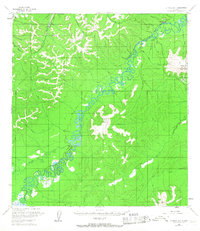
1954 · Iditarod D-1
USGS Topo · 1:63,360