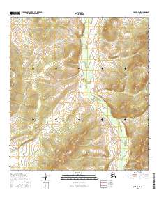
2016 Map of Ophir A-3 NE
USGS Topo · Published 2016About this map
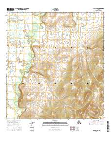
Tolstoi Creek dominates the interior drainage of this interior Alaska quadrangle, carving a winding path through the northern and central sections. This 2016 survey documents a landscape defined by its creek systems, with Dome Creek and Donovan Creek flowing through the eastern reaches. The terrain is structured by the Public Land Survey System grids of T26S and T27S, showing the systematic mapping of the Yukon-Koyukuk region. In this remote stretch of the Alaska interior, the map reveals a wilderness where natural watercourses are the primary geographical markers, notably where Baker Creek clips the southeastern corner. The high-resolution contour data from the National Elevation Dataset provides a clear view of the ridges and valleys that separate these drainages, offering a precise digital-era record of this undeveloped territory.
Find a feature on this map
10 named features on this map. Tap any name to fly to it.
Don’t see what you’re looking for? This feature index may not catch every label — zoom into the map to look around manually.
Map Details
Editions of this 2016 Ophir A-3 NE Map
This is the sole edition of this map. No revisions or reprints were ever made.
Other maps of this area

1951 · Ophir
USGS Topo · 1:250,000

1954 · Ophir A-2
USGS Topo · 1:63,360

1954 · Ophir A-3
USGS Topo · 1:63,360

1954 · Ophir B-2
USGS Topo · 1:63,360

1954 · Ophir B-3
USGS Topo · 1:63,360

1954 · Ophir
USGS Topo · 1:250,000
1965 · Ophir B-2
USGS Topo · 1:63,360
2015 · Ophir A-3 NW
USGS Topo · 1:25,000
2015 · Ophir B-3 SW
USGS Topo · 1:25,000
2016 · Ophir A-3 SW
USGS Topo · 1:25,000