
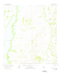
1954 Map of Ophir A-3
USGS Topo · Published 1965About this map
Dishna River meanders through an expansive wetland landscape in the interior of Alaska, as mapped during mid-1950s aerial surveys. This topographic study, published by the U.S. Geological Survey, illustrates a terrain dominated by low-relief swamps and intricate waterways. In the southeastern corner, the Hunter Trail provides a rare terrestrial route through the wilderness, skirting the drainage of Tolstoi Creek. The eastern portion of the quadrangle rises toward localized heights such as Dome, which stands above the valleys of Donovan Creek and Baker Creek. Because the land lines shown were unsurveyed and unmarked at the time of publication, the map reflects a raw, undeveloped frontier where natural drainage patterns and topographical relief dictated movement and potential land use.
Find a feature on this map
6 named features on this map. Tap any name to fly to it.
Don’t see what you’re looking for? This feature index may not catch every label — zoom into the map to look around manually.
Map Details
Editions of this 1954 Ophir A-3 Map
2 editions found
Other maps of this area

1951 · Ophir
USGS Topo · 1:250,000

1951 · Iditarod
USGS Topo · 1:250,000

1954 · Ophir A-2
USGS Topo · 1:63,360

1954 · Iditarod D-2
USGS Topo · 1:63,360

1954 · Ophir A-4
USGS Topo · 1:63,360

1954 · Ophir B-4
USGS Topo · 1:63,360

1954 · Ophir B-2
USGS Topo · 1:63,360

1954 · Iditarod D-3
USGS Topo · 1:63,360

1954 · Iditarod D-4
USGS Topo · 1:63,360

1954 · Ophir B-3
USGS Topo · 1:63,360