
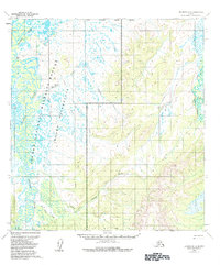
1954 Map of Iditarod D-4
USGS Topo · Published 1965About this map
The Iditarod River meanders through a labyrinth of oxbow lakes and wetlands in this 1954 topographic record of central Alaska. To the west, the river dominates the lowlands near the Dikeman (Site), while the eastern edge is defined by the Dishna River and the settlement at Windy. This era of exploration is evidenced by several overland routes, including the Tractor Trail and the Hunter Trail, which navigate the interior wilderness between the river basins.
Find a feature on this map
15 named features on this map. Tap any name to fly to it.
Don’t see what you’re looking for? This feature index may not catch every label — zoom into the map to look around manually.
Map Details
Editions of this 1954 Iditarod D-4 Map
2 editions found
Other maps of this area

1951 · Ophir
USGS Topo · 1:250,000

1951 · Iditarod
USGS Topo · 1:250,000

1954 · Iditarod C-4
USGS Topo · 1:63,360

1954 · Ophir A-5
USGS Topo · 1:63,360

1954 · Iditarod C-5
USGS Topo · 1:63,360

1954 · Iditarod C-3
USGS Topo · 1:63,360

1954 · Iditarod D-5
USGS Topo · 1:63,360

1954 · Ophir A-3
USGS Topo · 1:63,360

1954 · Ophir A-4
USGS Topo · 1:63,360

1954 · Iditarod D-3
USGS Topo · 1:63,360