
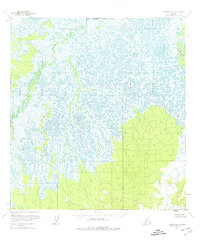
1954 Map of Iditarod D-5
USGS Topo · Published 1965About this map
The Iditarod River meanders sharply across a low-lying, wetland landscape in this mid-century topographic study. The drainage patterns of the Yetna River and the main Iditarod channel define the geography here, where the land is dominated by vast expanses of swamp and countless small lakes. Based on aerial photographs from 1953 and 1954, the map reveals a remote wilderness terrain devoid of roads or permanent settlements at the time of the survey. The intricate network of waterways and oxbow lakes suggests a highly dynamic river system, characteristic of the interior Alaskan bush before modern development or significant infrastructure altered the natural flow of these major tributaries.
Find a feature on this map
2 named features on this map. Tap any name to fly to it.
Don’t see what you’re looking for? This feature index may not catch every label — zoom into the map to look around manually.
Map Details
Editions of this 1954 Iditarod D-5 Map
3 editions found
Other maps of this area

1951 · Ophir
USGS Topo · 1:250,000

1951 · Iditarod
USGS Topo · 1:250,000

1954 · Ophir A-6
USGS Topo · 1:63,360

1954 · Iditarod D-6
USGS Topo · 1:63,360

1954 · Iditarod C-4
USGS Topo · 1:63,360

1954 · Ophir A-5
USGS Topo · 1:63,360

1954 · Iditarod C-5
USGS Topo · 1:63,360
1954 · Iditarod C-6
USGS Topo · 1:63,360

1954 · Ophir A-4
USGS Topo · 1:63,360

1954 · Iditarod D-4
USGS Topo · 1:63,360