
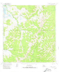
1954 Map of Iditarod C-4
USGS Topo · Published 1964About this map
The Iditarod River meanders through this interior Alaska landscape, captured during a mid-1950s survey that reveals the primitive transportation network of the era. The terrain is defined by a dense web of waterways, including Twin Island Creek, Moose Creek, and Hickey Creek, which drain into the main river channel. Evidence of human presence is sparse but significant, marked by a lone Cabin and seasonal routes like the Summer Trail and an Approximate Trail that navigate the ridges between the Otter Creek and Dishna River drainages. This map illustrates the reliance on river valleys and seasonal overland paths before modern infrastructure reached this part of the Yukon-Koyukuk region, showing how the North Fork and South Fork served as natural corridors through the wilderness.
Find a feature on this map
13 named features on this map. Tap any name to fly to it.
Don’t see what you’re looking for? This feature index may not catch every label — zoom into the map to look around manually.
Map Details
Editions of this 1954 Iditarod C-4 Map
2 editions found
Other maps of this area

1951 · Iditarod
USGS Topo · 1:250,000

1954 · Iditarod B-5
USGS Topo · 1:63,360

1954 · Iditarod C-5
USGS Topo · 1:63,360

1954 · Iditarod C-3
USGS Topo · 1:63,360

1954 · Iditarod B-3
USGS Topo · 1:63,360

1954 · Iditarod D-5
USGS Topo · 1:63,360

1954 · Iditarod B-4
USGS Topo · 1:63,360

1954 · Iditarod D-3
USGS Topo · 1:63,360

1954 · Iditarod D-4
USGS Topo · 1:63,360

1956 · Iditarod
USGS Topo · 1:250,000