
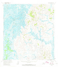
1954 Map of Ophir A-4
USGS Topo · Published 1965About this map
The Iditarod River meanders through the western reaches of this interior Alaska landscape, creating a complex network of oxbow lakes and sloughs across the low-lying wetlands. Surveyed in the mid-1950s, the map illustrates the transition from these saturated river bottoms to the rising uplands to the east. Several prominent topographic heights are identified by name, including Lonesome 978 in the southeast and Lazy 917 further north. This region, part of the Kuskokwim River drainage system, is shown in its raw, unpopulated state, with no roads or trails recorded at the time of the survey. The absence of human infrastructure highlights the territory's character as a wilderness corridor where movement was largely dictated by the winding course of the river and the surrounding muskeg. Insights from the Bureau of Land Management and Geological Survey records indicate these land lines remained unsurveyed and unmarked at the time of publication.
Find a feature on this map
4 named features on this map. Tap any name to fly to it.
Don’t see what you’re looking for? This feature index may not catch every label — zoom into the map to look around manually.
Map Details
Editions of this 1954 Ophir A-4 Map
2 editions found
Other maps of this area

1951 · Ophir
USGS Topo · 1:250,000

1951 · Iditarod
USGS Topo · 1:250,000

1954 · Ophir A-5
USGS Topo · 1:63,360

1954 · Iditarod D-5
USGS Topo · 1:63,360

1954 · Ophir A-3
USGS Topo · 1:63,360

1954 · Ophir B-4
USGS Topo · 1:63,360

1954 · Iditarod D-3
USGS Topo · 1:63,360

1954 · Iditarod D-4
USGS Topo · 1:63,360

1954 · Ophir B-3
USGS Topo · 1:63,360

1954 · Ophir B-5
USGS Topo · 1:63,360