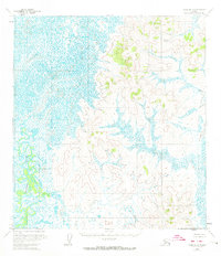
1954 Map of Ophir A-4
USGS Topo · Published 1974About this map
The Iditarod River meanders through a vast expanse of wetlands and low-relief terrain in this mid-century survey of the Alaska interior. The landscape is characterized by a stark division between the intricate, waterlogged patterns of the western basin and the rising elevations to the east. Topography by the U.S. Geological Survey reveals isolated high points such as Chick and Lonesome, which stand as significant landmarks in an otherwise feature-sparse wilderness. The mapping represents a transition in cartographic technique, utilizing photogrammetric methods from aerial photographs taken between 1953 and 1955. This specific quadrangle captures a moment before modern infrastructure, where the natural drainage of the river system dictated the only navigable routes through the region.
Find a feature on this map
3 named features on this map. Tap any name to fly to it.
Don’t see what you’re looking for? This feature index may not catch every label — zoom into the map to look around manually.
Map Details
Editions of this 1954 Ophir A-4 Map
2 editions found
Other maps of this area

1951 · Ophir
USGS Topo · 1:250,000

1951 · Iditarod
USGS Topo · 1:250,000

1954 · Ophir A-5
USGS Topo · 1:63,360

1954 · Iditarod D-5
USGS Topo · 1:63,360

1954 · Ophir A-3
USGS Topo · 1:63,360

1954 · Ophir A-4
USGS Topo · 1:63,360

1954 · Ophir B-4
USGS Topo · 1:63,360

1954 · Iditarod D-3
USGS Topo · 1:63,360

1954 · Iditarod D-4
USGS Topo · 1:63,360

1954 · Ophir B-3
USGS Topo · 1:63,360