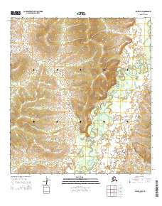
2015 Map of Ophir B-3 SW
USGS Topo · Published 2015About this map
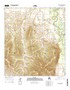
The Dishna River serpentines through this remote interior landscape, its numerous oxbows and abandoned channels testifying to the shifting hydrology of the Yukon-Koyukuk region. In this 2015 survey by the U.S. Geological Survey, the land is defined by topographic contrast, where high, ridged terrain in the western townships like t25s r7e and t24s r7e gives way to the broad, saturated river valley to the east. The map provides a high-resolution look at the drainage patterns of the Dishna as it cuts through the township of t25s r8e, revealing a complex network of wetlands and seasonal water bodies typical of the Alaskan bush. This area remains largely unsettled, serving as a study in natural geomorphology and untouched wilderness in the early 21st century.
Find a feature on this map
7 named features on this map. Tap any name to fly to it.
Don’t see what you’re looking for? This feature index may not catch every label — zoom into the map to look around manually.
Map Details
Editions of this 2015 Ophir B-3 SW Map
This is the sole edition of this map. No revisions or reprints were ever made.
Other maps of this area

1951 · Ophir
USGS Topo · 1:250,000

1954 · Ophir A-3
USGS Topo · 1:63,360

1954 · Ophir A-4
USGS Topo · 1:63,360

1954 · Ophir B-4
USGS Topo · 1:63,360

1954 · Ophir B-3
USGS Topo · 1:63,360

1954 · Ophir
USGS Topo · 1:250,000
2015 · Ophir A-3 NW
USGS Topo · 1:25,000
2015 · Ophir B-4 SE
USGS Topo · 1:25,000
2015 · Ophir A-4 NE
USGS Topo · 1:25,000
2015 · Ophir B-3 NW
USGS Topo · 1:25,000