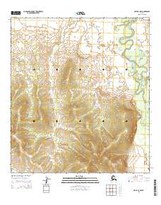
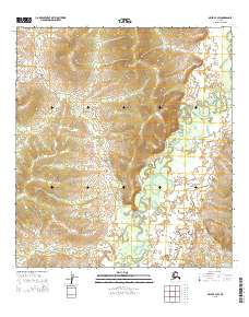
2015 Map of Ophir B-3 NW
USGS Topo · Published 2015About this map
The Dishna River meanders through the eastern section of this interior Alaska landscape, creating a complex series of oxbows and abandoned channels. This 2015 survey, published by the U.S. Geological Survey, illustrates the hydrologic patterns of the river basin where it meets Tolstoi Cr in the northern reaches of the quadrangle. The terrain is characterized by subtle elevation changes as the river system works through the low-lying wetlands and alluvial plains. Mapping of this area reflects the ongoing effort to document the remote Yukon-Koyukuk region using contemporary satellite imagery and elevation data, providing a detailed reference of the drainage patterns and township boundaries within the T23S and T24S ranges.
Find a feature on this map
6 named features on this map. Tap any name to fly to it.
Don’t see what you’re looking for? This feature index may not catch every label — zoom into the map to look around manually.
Map Details
Editions of this 2015 Ophir B-3 NW Map
This is the sole edition of this map. No revisions or reprints were ever made.
Other maps of this area

1951 · Ophir
USGS Topo · 1:250,000

1954 · Ophir C-3
USGS Topo · 1:63,360

1954 · Ophir B-4
USGS Topo · 1:63,360

1954 · Ophir B-3
USGS Topo · 1:63,360

1954 · Ophir C-4
USGS Topo · 1:63,360

1954 · Ophir
USGS Topo · 1:250,000
2015 · Ophir C-3 SW
USGS Topo · 1:25,000
2015 · Ophir B-4 SE
USGS Topo · 1:25,000
2015 · Ophir C-4 SE
USGS Topo · 1:25,000
2015 · Ophir B-3 SW
USGS Topo · 1:25,000