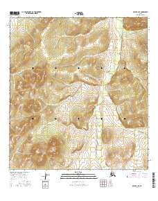
2016 Map of Ophir A-3 SE
USGS Topo · Published 2016About this map
The interior landscape of Alaska's Yukon-Koyukuk region is defined here by the winding course of Tolstoi Cr. This 2016 survey illustrates the high-latitude drainage patterns and elevation contours characteristic of the subarctic wilderness. The topography is predominantly represented through detailed contour lines that reveal a series of ridges and valleys, providing an essential resource for understanding the physical geography of this unpopulated corridor. The map serves as a precise record of the natural terrain, focusing on the hydraulic path of Tolstoi Cr as it meanders through the Public Land Survey System grids, specifically crossing through townships including T28S R9E and T29S R9E.
Find a feature on this map
10 named features on this map. Tap any name to fly to it.
Don’t see what you’re looking for? This feature index may not catch every label — zoom into the map to look around manually.
Map Details
Editions of this 2016 Ophir A-3 SE Map
This is the sole edition of this map. No revisions or reprints were ever made.
Other maps of this area

1951 · Ophir
USGS Topo · 1:250,000

1951 · Iditarod
USGS Topo · 1:250,000

1954 · Ophir A-2
USGS Topo · 1:63,360

1954 · Iditarod D-2
USGS Topo · 1:63,360

1954 · Ophir A-3
USGS Topo · 1:63,360

1954 · Iditarod D-3
USGS Topo · 1:63,360

1954 · Ophir
USGS Topo · 1:250,000

1956 · Iditarod
USGS Topo · 1:250,000
2015 · Ophir A-3 NW
USGS Topo · 1:25,000
2016 · Ophir A-3 SW
USGS Topo · 1:25,000