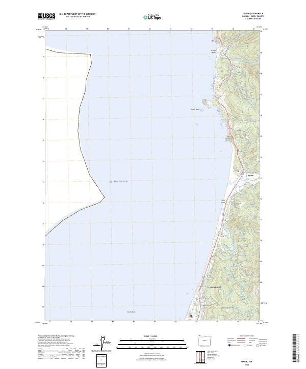
2024 Map of Ophir
USGS Topo · Published 2024About this map
Ophir and Nesika Beach occupy a thin strip of the Oregon coast, where the Pacific shoreline meets the steep, wooded hills of Curry County. This modern survey illustrates a landscape primarily defined by its interaction with the sea, featuring rocky landmarks like Sisters Rocks and the narrow ridge of Devils Backbone. Public land management is a significant presence here, with much of the offshore area and immediate coastline protected within the Oregon Islands National Wildlife Refuge and Oregon Islands Wilderness.
Find a feature on this map
31 named features on this map. Tap any name to fly to it.
Don’t see what you’re looking for? This feature index may not catch every label — zoom into the map to look around manually.
Map Details
Editions of this 2024 Ophir Map
This is the sole edition of this map. No revisions or reprints were ever made.
Other maps of this area

1899 · Port Orford
USGS Topo · 1:125,000

1903 · Port Orford
USGS Topo · 1:125,000

1954 · Coos Bay
USGS Topo · 1:250,000

1954 · Port Orford
USGS Topo · 1:62,500

1954 · Gold Beach
USGS Topo · 1:62,500

1958 · Coos Bay
USGS Topo · 1:250,000

1962 · Coos Bay
USGS Topo · 1:250,000
1986 · Father Mountain
USGS Topo · 1:24,000
1986 · Ophir
USGS Topo · 1:24,000
1986 · Port Orford
USGS Topo · 1:24,000