
2014 Map of Oracle
USGS Topo · Published 2014About this map
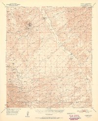
Oracle and the northern slopes of the Santa Catalina Mountains dominate this landscape, where the high desert transitions into the mountainous terrain of the Coronado National Forest. In the lower elevations, residential developments such as Saddle Brooke, Catalina, and Casa del Oro appear as structured grids against the sprawling drainage networks of Big Wash and Cañada del Oro. The map captures a detailed view of the local infrastructure, including the Az-77 corridor and a complex of local roads like W Oracle Ranch Rd and E Mt Lemmon Rd. Higher in the forest, the geography becomes defined by prominent summits and ridgelines, including Oracle Ridge, Apache Peak, and Rice Peak. Water sources such as Rancheria Spring, Irene Well, and Pig Spring reflect the essential points of navigation and utility in this arid environment, while the crossing at Charouleau Gap connects the distinct drainage basins of the range.
Find a feature on this map
90 named features on this map. Tap any name to fly to it.
Don’t see what you’re looking for? This feature index may not catch every label — zoom into the map to look around manually.
Map Details
Editions of this 2014 Oracle Map
This is the sole edition of this map. No revisions or reprints were ever made.
Other maps of this area

1904 · Tucson
USGS Topo · 1:125,000

1905 · Tucson
USGS Topo · 1:125,000

1911 · Winkelman
USGS Topo · 1:125,000

1913 · Winkelman
USGS Topo · 1:125,000

1948 · Mammoth
USGS Topo · 1:62,500

1948 · Mammoth
USGS Topo · 1:24,000

1948 · Campo Bonito
USGS Topo · 1:24,000

1949 · Mammoth
USGS Topo · 1:24,000

1949 · Campo Bonito
USGS Topo · 1:24,000
1951 · Mammoth
USGS Topo · 1:62,500