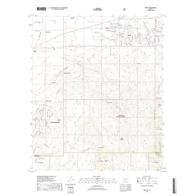
2018 Map of Oracle
USGS Topo · Published 2018About this map
Oracle serves as the focal point of this northern Pinal County survey, situated where the high desert meets the northern slopes of the Santa Catalina Mountains. The map reveals a transition from the established community of Oracle to the modern residential expansion at Saddlebrooke and Casa del Oro. This 2018 edition provides a clear view of how development has navigated the complex network of washes, including Big Wash and Chirreones Arroyo, which drain the surrounding foothills.
Find a feature on this map
107 named features on this map. Tap any name to fly to it.
Don’t see what you’re looking for? This feature index may not catch every label — zoom into the map to look around manually.
Map Details
Editions of this 2018 Oracle Map
This is the sole edition of this map. No revisions or reprints were ever made.
Other maps of this area

1904 · Tucson
USGS Topo · 1:125,000

1905 · Tucson
USGS Topo · 1:125,000

1911 · Winkelman
USGS Topo · 1:125,000

1913 · Winkelman
USGS Topo · 1:125,000

1948 · Mammoth
USGS Topo · 1:62,500

1948 · Mammoth
USGS Topo · 1:24,000

1948 · Campo Bonito
USGS Topo · 1:24,000

1949 · Mammoth
USGS Topo · 1:24,000

1949 · Campo Bonito
USGS Topo · 1:24,000
1951 · Mammoth
USGS Topo · 1:62,500