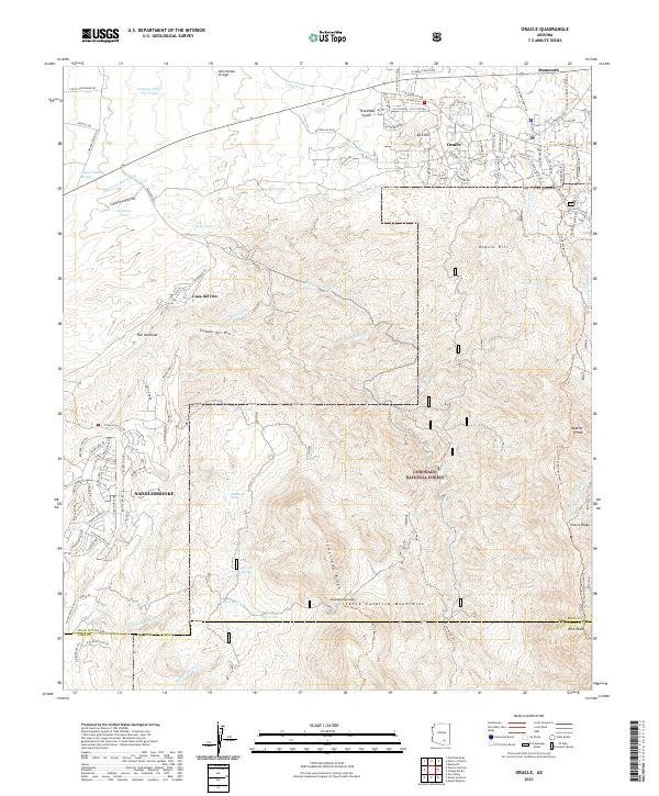
2021 Map of Oracle
USGS Topo · Published 2021About this map
Oracle and its surrounding communities sit at the gateway to the northern reaches of the Coronado National Forest in this 2021 study. The landscape transition is evident as residential developments like Saddlebrooke and Casa del Oro meet the rising elevations of the Santa Catalina Mountains. The northern terrain is defined by complex drainage systems such as Cañada del Oro, Copper Hill Wash, and Rainbows End Wash, which carve through the foothills. Further south, the map details the high-altitude topography of Samaniego Ridge and Charouleau Gap. This recent survey provides a clear view of modern road networks including Biosphere Rd and S Coulter Dam Rd, alongside established geographic landmarks like Apache Peak and Oracle Hill. Numerous tanks and springs, such as Ruin Tank and Pig Spring, dot the landscape, indicating the critical role of water management in this high-desert environment.
Find a feature on this map
119 named features on this map. Tap any name to fly to it.
Don’t see what you’re looking for? This feature index may not catch every label — zoom into the map to look around manually.
Map Details
Editions of this 2021 Oracle Map
This is the sole edition of this map. No revisions or reprints were ever made.
Other maps of this area

1904 · Tucson
USGS Topo · 1:125,000

1905 · Tucson
USGS Topo · 1:125,000

1911 · Winkelman
USGS Topo · 1:125,000

1913 · Winkelman
USGS Topo · 1:125,000

1948 · Mammoth
USGS Topo · 1:62,500

1948 · Mammoth
USGS Topo · 1:24,000

1948 · Campo Bonito
USGS Topo · 1:24,000

1949 · Mammoth
USGS Topo · 1:24,000

1949 · Campo Bonito
USGS Topo · 1:24,000
1951 · Mammoth
USGS Topo · 1:62,500