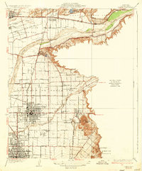
1935 Map of Orange
USGS Topo · Published 1935About this map
The Santa Ana River carves through the landscape of the mid-1930s, anchoring a network of agricultural settlements and early suburban expansion. Significant citrus-era infrastructure is visible in the irrigation canals and the dual presence of the Atchison Topeka and Santa Fe and Southern Pacific railroads, which facilitated the region's transport economy. The residential core of Orange is shown in high detail, surrounded by satellite communities like McPherson, El Modeno, and Villa Park.
Find a feature on this map
45 named features on this map. Tap any name to fly to it.
Don’t see what you’re looking for? This feature index may not catch every label — zoom into the map to look around manually.
Map Details
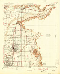
Editions of this 1935 Orange Map
2 editions found
Other maps of this area

1896 · Santa Ana
USGS Topo · 1:62,500

1896 · Anaheim
USGS Topo · 1:62,500

1898 · Anaheim
USGS Topo · 1:62,500

1901 · Southern California Sheet No. 1
USGS Topo · 1:250,000

1901 · Santa Ana
USGS Topo · 1:62,500

1901 · Anaheim
USGS Topo · 1:62,500

1902 · Corona
USGS Topo · 1:125,000

1904 · Southern California Sheet No. 1
USGS Topo · 1:250,000

1932 · Orange
USGS Topo · 1:31,680

1932 · Newport Beach
USGS Topo · 1:31,680