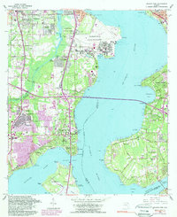
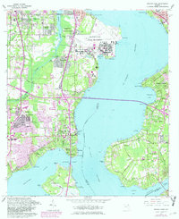
1964 Map of Orange Park
USGS Topo · Published 1982About this map
The Jacksonville Naval Air Station dominates the western shore of the St Johns River, showing the extensive runways and military infrastructure during the mid-1960s. Across the wide expanse of the river, the residential communities of Mandarin and East Mandarin retain a more rural character, marked by the Mandarin Cem and numerous family-named landmarks like Plummers Point and Beauclerc Bluff. This period captures the expanding suburban footprint of Orange Park south of the Duval and Clay County line, where new developments like Meadowbrook Terrace are visible alongside established sites like Wadesboro Springs.
Find a feature on this map
86 named features on this map. Tap any name to fly to it.
Don’t see what you’re looking for? This feature index may not catch every label — zoom into the map to look around manually.
Map Details
Editions of this 1964 Orange Park Map
5 editions found
Other maps of this area

1917 · Orange Park
USGS Topo · 1:62,500

1917 · Cambon
USGS Topo · 1:62,500

1918 · Middleburg
USGS Topo · 1:62,500

1918 · Cambon
USGS Topo · 1:62,500

1918 · Jacksonville
USGS Topo · 1:62,500

1918 · Orange Park
USGS Topo · 1:62,500

1941 · Middleburg
USGS Topo · 1:62,500

1948 · Jacksonville
USGS Topo · 1:250,000

1949 · Middleburg
USGS Topo · 1:24,000

1949 · Jacksonville Heights
USGS Topo · 1:24,000