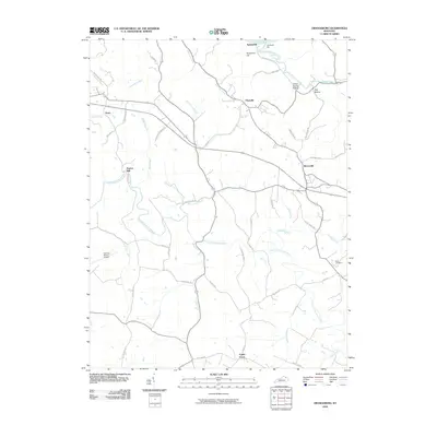
2010 Map of Orangeburg
USGS Topo · Published 2010About this map
The North Fork Licking River winds through this rural landscape in Mason County, where small agricultural hubs like Plumville and Rectorville anchor a network of traditional pikes and lanes. This 2010 depiction reveals the enduring rural structure of the region, from the riverside settlement of Springdale along the Ohio River to the inland crossroads of Poplar Grove. Local family history is centered near the Nash Cemetery and the site of Taylors Mill, while the modern Fleming-Mason Airport stands as a primary landmark in the southwest.
Find a feature on this map
53 named features on this map. Tap any name to fly to it.
Don’t see what you’re looking for? This feature index may not catch every label — zoom into the map to look around manually.
Map Details
Editions of this 2010 Orangeburg Map
This is the sole edition of this map. No revisions or reprints were ever made.
Other maps of this area

1915 · Maysville
USGS Topo · 1:62,500

1919 · Maysville
USGS Topo · 1:62,500

1929 · Springdale
USGS Topo · 1:48,000

1935 · Springdale
USGS Topo · 1:62,500

1951 · Burtonville
USGS Topo · 1:24,000

1951 · Flemingsburg
USGS Topo · 1:24,000

1952 · Maysville East
USGS Topo · 1:24,000

1952 · Elizaville
USGS Topo · 1:24,000

1952 · Maysville West
USGS Topo · 1:24,000
1952 · Orangeburg
USGS Topo · 1:24,000