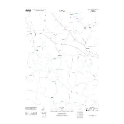
2013 Map of Orangeburg
USGS Topo · Published 2013About this map
The N Fork Licking River winds through this central Kentucky landscape, defining the topography south of the Ohio River valley near Maysville. In 2013, the region maintained its rural character, anchored by small settlements like Orangeburg and Plumville. The map captures a network of historical thoroughfares, including the Polecat Pike and Dixon Pike, which connect long-standing communities such as Rectorville and Somo. Genealogists may find interest in the Nash Cem located near the river's bend or the family-named hollows like Owl Hollow and Camp Spring Hollow. The presence of Taylors Mill and Mount Gilead suggests a history of local commerce and community gatherings. To the west, the Fleming-Mason Airport stands as a modern landmark amidst the creek-fed valleys of Stone Lick Br and Indian Run, while Grant Lake provides a localized water feature in this upland terrain.
Find a feature on this map
73 named features on this map. Tap any name to fly to it.
Don’t see what you’re looking for? This feature index may not catch every label — zoom into the map to look around manually.
Map Details
Editions of this 2013 Orangeburg Map
This is the sole edition of this map. No revisions or reprints were ever made.
Other maps of this area

1915 · Maysville
USGS Topo · 1:62,500

1919 · Maysville
USGS Topo · 1:62,500

1929 · Springdale
USGS Topo · 1:48,000

1935 · Springdale
USGS Topo · 1:62,500

1951 · Burtonville
USGS Topo · 1:24,000

1951 · Flemingsburg
USGS Topo · 1:24,000

1952 · Maysville East
USGS Topo · 1:24,000

1952 · Elizaville
USGS Topo · 1:24,000

1952 · Maysville West
USGS Topo · 1:24,000
1952 · Orangeburg
USGS Topo · 1:24,000