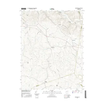
2016 Map of Orangeburg
USGS Topo · Published 2016About this map
Orangeburg sits at the center of this Kentucky landscape, where the local road network connects small agricultural communities across Mason and Fleming counties. The terrain is defined by the winding course of the North Fork Licking River and its numerous tributaries, including Stone Lick Br and Indian Run. This 2016 survey captures the rural character of the region, anchored by the Fleming-Mason Airport and the historic cemetery at Nash Cem.
Find a feature on this map
70 named features on this map. Tap any name to fly to it.
Don’t see what you’re looking for? This feature index may not catch every label — zoom into the map to look around manually.
Map Details
Editions of this 2016 Orangeburg Map
This is the sole edition of this map. No revisions or reprints were ever made.
Other maps of this area

1915 · Maysville
USGS Topo · 1:62,500

1919 · Maysville
USGS Topo · 1:62,500

1929 · Springdale
USGS Topo · 1:48,000

1935 · Springdale
USGS Topo · 1:62,500

1951 · Burtonville
USGS Topo · 1:24,000

1951 · Flemingsburg
USGS Topo · 1:24,000

1952 · Maysville East
USGS Topo · 1:24,000

1952 · Elizaville
USGS Topo · 1:24,000

1952 · Maysville West
USGS Topo · 1:24,000
1952 · Orangeburg
USGS Topo · 1:24,000