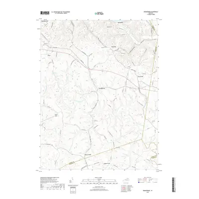
2019 Map of Orangeburg
USGS Topo · Published 2019About this map
Orangeburg stands at the center of this rural landscape, where the headwaters of the North Fork Licking River and its various branches, such as Stone Lick Br and Middle Run, carve through the Kentucky hills. This area, located south of Maysville, is characterized by a network of winding roads and scattered settlements that reflect generations of agricultural life. Smaller communities like Plumville, Rectorville, and Somo are connected by historically significant routes including the Old Plainville Pike and Orangeburg Rd.
Find a feature on this map
82 named features on this map. Tap any name to fly to it.
Don’t see what you’re looking for? This feature index may not catch every label — zoom into the map to look around manually.
Map Details
Editions of this 2019 Orangeburg Map
This is the sole edition of this map. No revisions or reprints were ever made.
Other maps of this area

1915 · Maysville
USGS Topo · 1:62,500

1919 · Maysville
USGS Topo · 1:62,500

1929 · Springdale
USGS Topo · 1:48,000

1935 · Springdale
USGS Topo · 1:62,500

1951 · Burtonville
USGS Topo · 1:24,000

1951 · Flemingsburg
USGS Topo · 1:24,000

1952 · Maysville East
USGS Topo · 1:24,000

1952 · Elizaville
USGS Topo · 1:24,000

1952 · Maysville West
USGS Topo · 1:24,000
1952 · Orangeburg
USGS Topo · 1:24,000