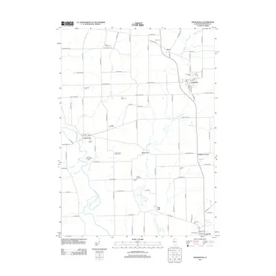
2012 Map of Orangeville
USGS Topo · Published 2012About this map
Pecatonica River meanders through this agricultural landscape of Stephenson County, carving a wide valley where McConnell and the Pleasure Valley Landing Area are situated. The settlement pattern is defined by a dense grid of rural roads and small villages like Orangeville, Oneco, and Cedarville, each anchored by historical burial grounds that offer deep genealogical value. This 2012 survey illustrates a well-preserved Midwestern township structure, where land is dotted with family and church-affiliated landmarks such as Shippy Salem Cem and Richland Salem Lutheran Cem. Waterways like Little Richland Cr and Muddy Cr provide the primary drainage for the surrounding farms, while small hamlets such as Buena Vista and Red Oak serve as quiet intersections in this productive northern Illinois corner.
Find a feature on this map
91 named features on this map. Tap any name to fly to it.
Don’t see what you’re looking for? This feature index may not catch every label — zoom into the map to look around manually.
Map Details
Editions of this 2012 Orangeville Map
This is the sole edition of this map. No revisions or reprints were ever made.
Other maps of this area

1920 · Monroe
USGS Topo · 1:62,500

1922 · Monroe
USGS Topo · 1:62,500

1923 · South Wayne
USGS Topo · 1:62,500

1937 · Lena
USGS Topo · 1:48,000

1939 · Freeport
USGS Topo · 1:48,000

1942 · Lena
USGS Topo · 1:62,500

1943 · Lena
USGS Topo · 1:62,500

1944 · Freeport
USGS Topo · 1:62,500

1954 · Rockford
USGS Topo · 1:250,000

1955 · Rockford
USGS Topo · 1:250,000