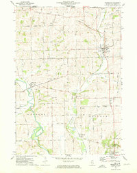
1971 Map of Orangeville
USGS Topo · Published 1974About this map
Orangeville and McConnell anchor this northern Illinois landscape just below the Wisconsin State Line during the early 1970s. The region is defined by the winding course of the Pecatonica River and the Illinois Central Gulf Railroad, which cuts through the heart of the terrain. The map reveals a deeply rooted agricultural and rural community, evidenced by the high density of country churches and burial grounds such as Richland Salem Church, Basswood Church, and Silent Hill Cemetery. Scattered quarries and gravel pits suggest local industry alongside the township divisions of Oneco, Waddams, and Buckeye. From the heights of Sanders Hill to the valley of Richland Creek, the survey documents the intricate network of section-line roads and small settlements like Buena Vista and Cedarville before later modernization.
Find a feature on this map
57 named features on this map. Tap any name to fly to it.
Don’t see what you’re looking for? This feature index may not catch every label — zoom into the map to look around manually.
Map Details
Editions of this 1971 Orangeville Map
This is the sole edition of this map. No revisions or reprints were ever made.
Other maps of this area

1920 · Monroe
USGS Topo · 1:62,500

1922 · Monroe
USGS Topo · 1:62,500

1923 · South Wayne
USGS Topo · 1:62,500

1937 · Lena
USGS Topo · 1:48,000

1939 · Freeport
USGS Topo · 1:48,000

1942 · Lena
USGS Topo · 1:62,500

1943 · Lena
USGS Topo · 1:62,500

1944 · Freeport
USGS Topo · 1:62,500

1954 · Rockford
USGS Topo · 1:250,000

1955 · Rockford
USGS Topo · 1:250,000