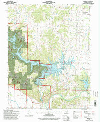
1996 Map of Oraville
USGS Topo · Published 1998About this map
Kinkaid Lake dominates this Jackson County landscape, its winding fingers stretching into the Shawnee National Forest following the 1990s imagery update. The map illustrates the region's managed recreational transition, featuring the Sharp Rock Falls Recreation Area and Glenn Schlimpert Recreation Area alongside the established Lake Murphysboro State Park. While the water provides the primary modern focus, the older rural character of the area remains visible through its network of small country churches and family burial grounds.
Find a feature on this map
35 named features on this map. Tap any name to fly to it.
Don’t see what you’re looking for? This feature index may not catch every label — zoom into the map to look around manually.
Map Details
Editions of this 1996 Oraville Map
This is the sole edition of this map. No revisions or reprints were ever made.
Other maps of this area

1910 · Murphysboro
USGS Topo · 1:62,500

1916 · Campbell Hill
USGS Topo · 1:62,500

1918 · Altenburg
USGS Topo · 1:62,500

1918 · Campbell Hill
USGS Topo · 1:62,500

1924 · Alto Pass
USGS Topo · 1:62,500

1925 · Altenburg
USGS Topo · 1:62,500

1938 · Murphysboro
USGS Topo · 1:62,500

1947 · Alto Pass
USGS Topo · 1:62,500

1947 · Gorham
USGS Topo · 1:24,000

1947 · Altenburg
USGS Topo · 1:62,500