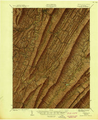
1944 Map of Orbisonia
USGS Topo · Published 1944About this map
Blacklog Mountain and Shade Mountain dominate this landscape, creating the characteristic linear ridges and narrow valleys of south-central Pennsylvania. The early 1940s infrastructure is headlined by the newly constructed Pennsylvania Turnpike, which cuts through the southern terrain near Burnt Cabins and Ft Littleton. This modern thoroughfare contrasts sharply with the established agrarian network of one-room schoolhouses like Wood-Cutting Sch and local industry sites such as Kuhns Mill and Hoovers Mill.
Find a feature on this map
118 named features on this map. Tap any name to fly to it.
Don’t see what you’re looking for? This feature index may not catch every label — zoom into the map to look around manually.
Map Details
Editions of this 1944 Orbisonia Map
3 editions found

Other maps of this area

1900 · Mercersburg
USGS Topo · 1:62,500

1901 · Huntingdon
USGS Topo · 1:62,500

1902 · Chambersburg
USGS Topo · 1:62,500

1902 · Mercersburg
USGS Topo · 1:62,500

1904 · Huntingdon
USGS Topo · 1:62,500

1919 · Mattawana
USGS Topo · 1:62,500

1922 · Mt Union
USGS Topo · 1:48,000

1923 · Shippensburg
USGS Topo · 1:62,500

1924 · Mt. Union
USGS Topo · 1:62,500

1925 · Needmore
USGS Topo · 1:48,000