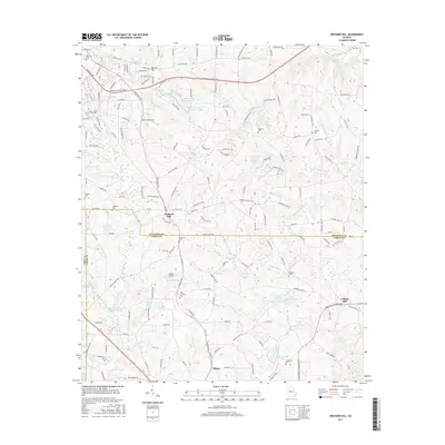
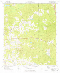
2017 Map of Orchard Hill
USGS Topo · Published 2017About this map
Orchard Hill and Milner serve as the primary hubs of activity along the Norfolk Southern railroad corridor in this 2017 survey of the Spalding and Lamar County border. The landscape is defined by its water resources, featuring a series of named reservoirs like W Crystal Lake, E Crystal Lake, and N Crystal Lake, alongside several Potato Creek structures designed for water management. A notable local landmark is Browns Mineral Spring, pointing to the area's geological history, while the presence of numerous small family and community burial grounds, such as Wadsworth Cem, New Crawley Cem, and Ogletree Cem, provides a detailed record of the region's ancestral settlement patterns. The topography transitions from the heights of Barrow Hill down toward the drainage basins of Potato Cr and its tributaries, reflecting a rural landscape where small-scale aviation at Toland Airport coexists with traditional agriculture and timber tracts.
Find a feature on this map
170 named features on this map. Tap any name to fly to it.
Don’t see what you’re looking for? This feature index may not catch every label — zoom into the map to look around manually.
Map Details
Editions of this 2017 Orchard Hill Map
This is the sole edition of this map. No revisions or reprints were ever made.
Other maps of this area

1951 · Barnesville
USGS Topo · 1:62,500

1953 · Atlanta
USGS Topo · 1:250,000

1957 · Atlanta
USGS Topo · 1:250,000

1958 · Atlanta
USGS Topo · 1:250,000

1964 · Luella
USGS Topo · 1:24,000
1964 · Locust Grove
USGS Topo · 1:24,000

1965 · Griffin North
USGS Topo · 1:24,000
1971 · Griffin South
USGS Topo · 1:24,000
1971 · Zebulon
USGS Topo · 1:24,000
1973 · Johnstonville
USGS Topo · 1:24,000