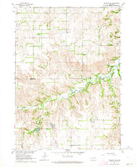
1963 Map of Orchard NW
USGS Topo · Published 1964About this map
South Branch Verdigre Creek and East Branch Verdigre Creek carve through the agricultural landscape of northern Nebraska, meeting just across the county line from Walnut Grove. This early 1960s survey captures a rural landscape defined by township boundaries like Logan and Sherman, where section lines dictate the placement of local infrastructure. Social life in this farming community centered on small hubs like the Pleasant Hill Sch and family burial sites including Enterprise Cem and Pleasant View Cem. The presence of a Fish Hatchery near Big Springs Creek and Hathaway Slough indicates a specialized use of the local water resources, while a Gravel Pit in the southern portion of the map suggests local industry supporting road maintenance and construction.
Find a feature on this map
15 named features on this map. Tap any name to fly to it.
Don’t see what you’re looking for? This feature index may not catch every label — zoom into the map to look around manually.
Map Details
Editions of this 1963 Orchard NW Map
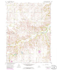
2 editions found
Other maps of this area

1954 · Walnut
USGS Topo · 1:24,000

1954 · Verdigre
USGS Topo · 1:24,000

1954 · Star
USGS Topo · 1:24,000

1955 · O'Neill
USGS Topo · 1:250,000

1959 · O'Neill
USGS Topo · 1:250,000

1963 · Orchard NE
USGS Topo · 1:24,000

1963 · Venus
USGS Topo · 1:24,000

1963 · Royal
USGS Topo · 1:24,000

1963 · Orchard
USGS Topo · 1:24,000

1963 · Ewing
USGS Topo · 1:24,000