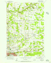
1954 Map of Orchards
USGS Topo · Published 1956About this map
Fourth Plain stretches across this mid-century landscape of Clark County, illustrating the post-war transition of Vancouver from a riverside town into a spreading suburban and agricultural network. The map reveals an intricate geography of rural education and faith, with numerous neighborhood landmarks like the Finnish Church, Bethel Cem, and Pleasant Valley School serving established farming communities. The Northern Pacific railroad cuts through the center of the sheet, linking settlements such as Brush Prairie, Homan, and Orchards. Local industry and recreation are represented by several Gravel Pits and the Royal Oaks Country Club, while the presence of the Portland Omni Radio Range Sta and multiple other towers reflects the era's growing technological infrastructure. Genealogists will find particular value in the clearly marked burial grounds, ranging from the Wilson Cemetery to the expansive Evergreen Memorial Gardens.
Find a feature on this map
48 named features on this map. Tap any name to fly to it.
Don’t see what you’re looking for? This feature index may not catch every label — zoom into the map to look around manually.
Map Details
Editions of this 1954 Orchards Map
This is the sole edition of this map. No revisions or reprints were ever made.
Other maps of this area

1897 · Portland
USGS Topo · 1:62,500

1905 · Portland
USGS Topo · 1:62,500

1918 · Troutdale
USGS Topo · 1:62,500

1934 · Troutdale
USGS Topo · 1:48,000

1940 · Portland
USGS Topo · 1:62,500

1940 · La Center
USGS Topo · 1:62,500

1941 · Yacolt
USGS Topo · 1:62,500

1941 · Camas
USGS Topo · 1:62,500

1942 · Camas
USGS Topo · 1:62,500

1948 · Vancouver
USGS Topo · 1:250,000